
A little room to wonder
Cities & Settlements
Compare settlement patterns without treating population totals or administrative labels as the whole place.
What makes two places with the same population work differently?
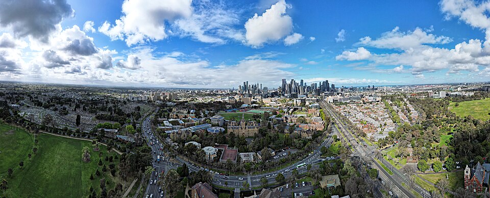
A settlement is a connected place
People live, work, learn and travel in places with different arrangements of buildings, services and open spaces. A settlement can be studied through its population, physical layout and connections with other places. Its administrative boundary may differ from the area people use in everyday life.
Statistical definitions help researchers compare places consistently, but they are made for particular purposes. The ABS distinguishes several geographic units. A statistical urban area is not automatically the same as a council area or a universal definition of a town.
Work through population density
In a fictional comparison, Place A has 1,000 residents across 2 square kilometres. Its average density is 500 residents per square kilometre. Place B has 2,000 across 10 square kilometres, giving 200 per square kilometre. B has more residents, while A has the higher average density.
An average across a boundary can hide concentration within it. Half of Place B might contain most of its residents while another part is open land. Before comparing densities, check how the boundaries were drawn and whether the data refer to the same time and population definition.
Access involves networks
A service’s straight-line distance does not establish how easy it is to reach. Crossings, routes, public transport, opening times and different ways of moving all matter. A fictional library across a creek may be close on a map but far along the available paths.
Planning approaches that consider nearby daily needs examine these relationships rather than buildings alone. A useful project can map connections and identify an assumption to check. It should not decide what every resident needs without hearing from the people involved.
Places have histories and choices
A layout can reflect earlier transport, land use and decisions that still shape movement. New development creates trade-offs involving different users and environments. Compare a clearly stated question, such as which route reaches an invented service, and distinguish a design proposal from evidence that a real change would work.
Only if you feel like trying
Compare two imaginary settlements
- Draw two different layouts for the same fictional population.
- Label a service, a barrier and the available routes in each.
- Explain why an equal population or distance does not guarantee equal access.
Optional invented planning exercise. No home location, personal travel log, public survey or claim to represent a community is needed.
Look at the sources.
These references informed this introduction. You can check who published them, what evidence they use and whether you would ask another question.
- Australian Bureau of StatisticsUsing the ASGS: Edition 4
- Victorian Government, Department of Transport and Planning20-minute neighbourhoods
Research checked 1 November 2026. External pages have their own content and privacy practices.
Where could this connect?
These are editorial links between subjects. You choose which, if any, to follow.
Geography
Settlement connects people’s activities with spatial patterns and environments.
Follow this connection
Human-centred Design
Understanding different users matters before proposing changes to a shared place.
Follow this connectionMaps & Scale
Boundaries, scale and route measurements affect comparisons between places.
Follow this connection