
A little room to wonder
Place Histories & Change
Compare historical views of a place while checking dates, purpose, boundaries and what is absent.
How can you show that a place changed without assuming why it changed?
Define the place and period
A place can mean a street, a waterway, a neighbourhood or a wider landscape. Decide which area and period your question concerns. Names and boundaries can change, so a familiar name is not enough to establish that two records refer to exactly the same area.
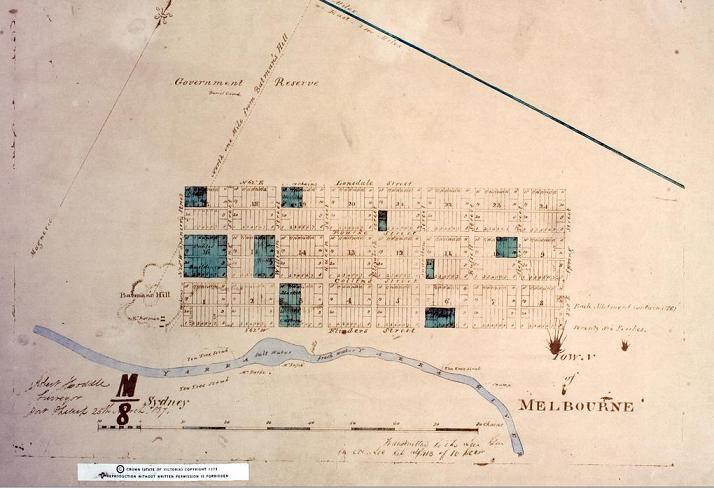
A place history can combine maps, photographs, objects, written records and recorded accounts. Each reveals a selected view. A survey plan may record boundaries in detail while saying little about everyday experience or relationships with Country.
Check what the map represents
Maps can show proposed layouts, administrative divisions or features observed at a particular time. The date of the map, its purpose and its key affect the interpretation. A road on a plan is evidence that it was represented there, not automatic proof that it was constructed and used then.
A colonial survey is also a record made from a particular position. The absence of people, activities or cultural meanings from that map is not evidence that they were absent from the place. Seek relevant perspectives without treating one source as a complete account.
Work through two fictional views
An invented map from 1950 labels a site “rail yard”. An invented 1990 photograph shows a park at the same identified site. Together they support a change in represented land use between those records. They do not yet establish the year of conversion, who decided it or what different people thought.
A dated planning record, opening report or other contemporary evidence could narrow the sequence. Make a timeline with confirmed dates and an explicitly uncertain interval. This is more accurate than inserting a guessed date halfway between the two sources.
Explain change at the right scale
One changed building does not establish that every part of a town changed in the same way. Likewise, a continuing street name does not prove an unchanged place. State which features you compared and what remains outside the inquiry. An invented example can teach the method without requiring anyone’s private history.
Only if you feel like trying
Make an uncertainty-aware timeline
- Draw two fictional views of the same site at different dates.
- List two changes and one feature that appears to continue.
- Place an uncertain interval on a timeline and name one source that could narrow it.
Optional fictional exercise. Do not disclose addresses, interview people or reproduce culturally restricted material.
Look at the sources.
These references informed this introduction. You can check who published them, what evidence they use and whether you would ask another question.
- State Library VictoriaMaps for local and family history: Why use maps?
- Museums VictoriaGather materials
Research checked 1 November 2026. External pages have their own content and privacy practices.
Where could this connect?
These are editorial links between subjects. You choose which, if any, to follow.
Cities & Settlements
Earlier land use and transport arrangements can shape a settlement’s later form.
Follow this connection
History
A place history builds an explanation from dated sources and their limitations.
Follow this connectionMaps & Scale
Changed boundaries, scale and map purpose affect what two views can fairly compare.
Follow this connection