
Geography · Investigate
Compare two invented transport routes
What makes a route useful when distance is only one consideration?
Compare two fictional routes using a stated goal as well as their distance.
10–20 minutes, or one small comparison for a first try. More time is optional.
Start here
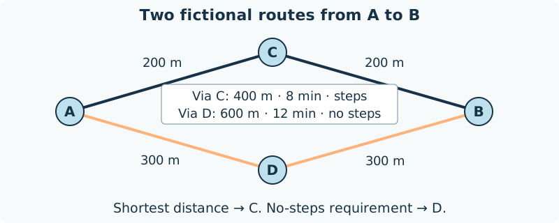
Draw two routes from A to B: a short route through C and a longer route through D.
Use your idea or the example below. Talk, write, draw, point or listen first. You can stop after one step.
Try it your way.
Supply the facts
Route A–C–B has two 200 m legs, takes 8 invented minutes and includes steps. Route A–D–B has two 300 m legs, takes 12 invented minutes and has no steps.
Name one criterion
Choose a fictional requirement such as shortest distance or no steps. You do not need to disclose a personal reason for choosing it.
Compare against it
Shortest distance favours A–C–B: 400 m. The no-steps requirement favours A–D–B: 600 m. Each answer names its criterion.
List missing facts
Surface, slope, weather and other access details are not supplied. Do not turn no steps into a claim that every person can use the route.
One possible version
Original model: two routes to a display hall
Distances, times and route features are supplied fictional data, not real transport information.
- Via C: 200 + 200 = 400 m; 8 minutes; steps.
- Via D: 300 + 300 = 600 m; 12 minutes; no steps.
- For a no-steps requirement choose D; for minimum distance choose C, given only these facts.
The invented minutes are given data, not a general walking-speed rule. No-steps alone does not establish full accessibility.
Something to keep?
What changed when I changed the criterion?
You can keep a question, a sketch or a change of mind. A finished product is optional.
This opens an editable starter in your project tools. It asks before replacing open work. Choosing it does not save or share your work automatically.